
The structural building for the main lithostratigraphic parts of a section is performed using a velocity model of the real medium in the form of structural maps, maps of isochrones and of interval times (isopaches) for the targeted horizons and layers.
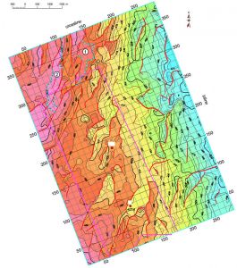
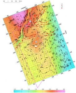
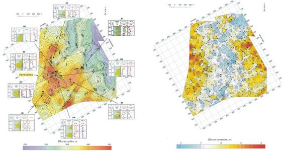
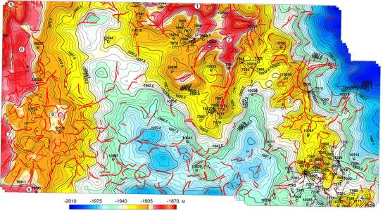
In the complex analysis of the interpretation results "structure factor" is one of the main criterion of the whole set of hydrocarbon potential criteria. This criterion largely controls the path of hydrocarbon migration due to the better conduction paths for them in the reservoir crest and the best conditions of the traps formation for the hydrocarbon accumulations. At the same time, studied structural forms are considered from the viewpoint of a geodynamic model of the structure (geodynamic classification) and in terms of shape (morphological classification); while, the faults are classified according to the direction of the movement of the break wings (fault fissure).
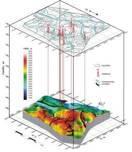
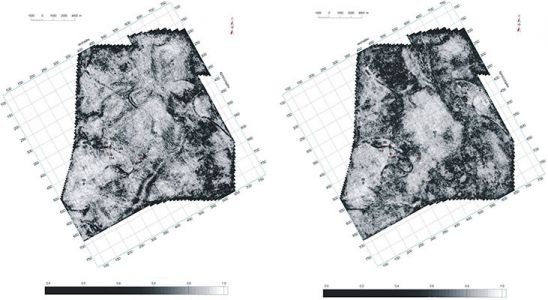
Recovered acoustic heterogeneities of the real medium with high resolution (based on the use of AI and RC sections and cubes) also allow to explore the ancient paleo-rivers riverbed, structure elements of their filling (in the form of acoustic inhomogeneities), river incisions of paleovalleys riverbed, the erosion depth and etc.
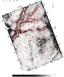
Highly informative results are also obtained using structural imaging and mapping of litho-facies changes in the targeted deposits with the AI and RC sections and cubes in high resolution.